
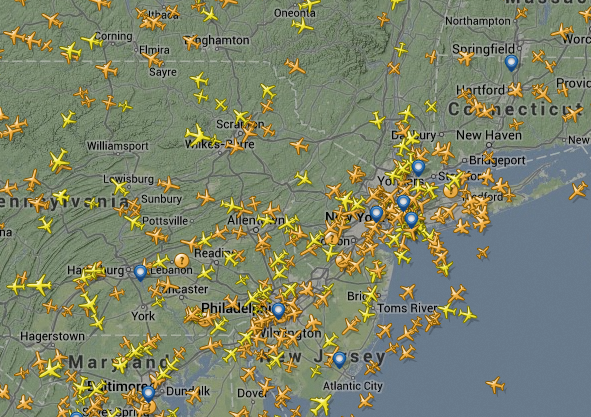
If you want to get an idea of how things work, it’s good to get an aerial view. A number of projects recently have used demographic and social media data to create maps of our movements and actions. Flight Radar uses traffic control data to map out where all the flights in the world are in real time. Trainspotting for Gen Y.